SADGIS
A pollution scattering simulation software based on ArcGIS.
Code : Github
Date : Summer 2015
Role : Lead Programmer
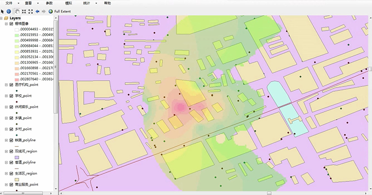
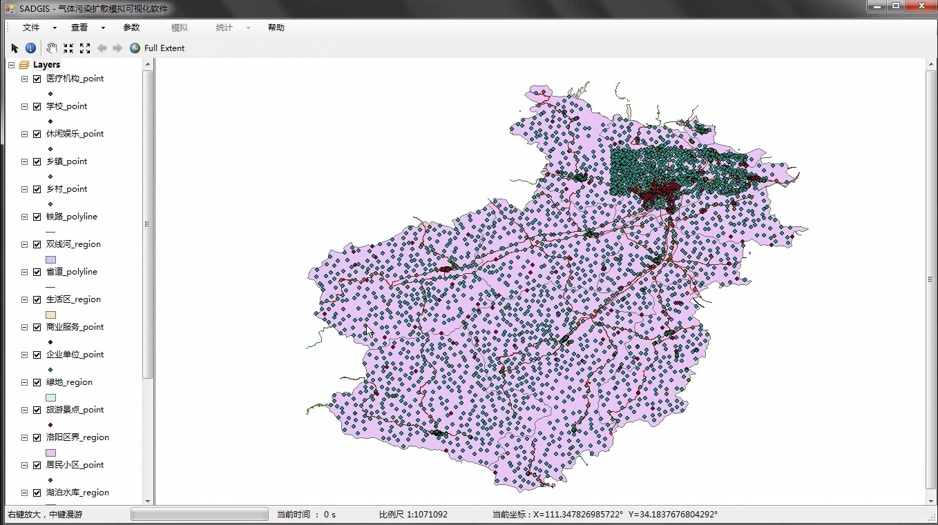
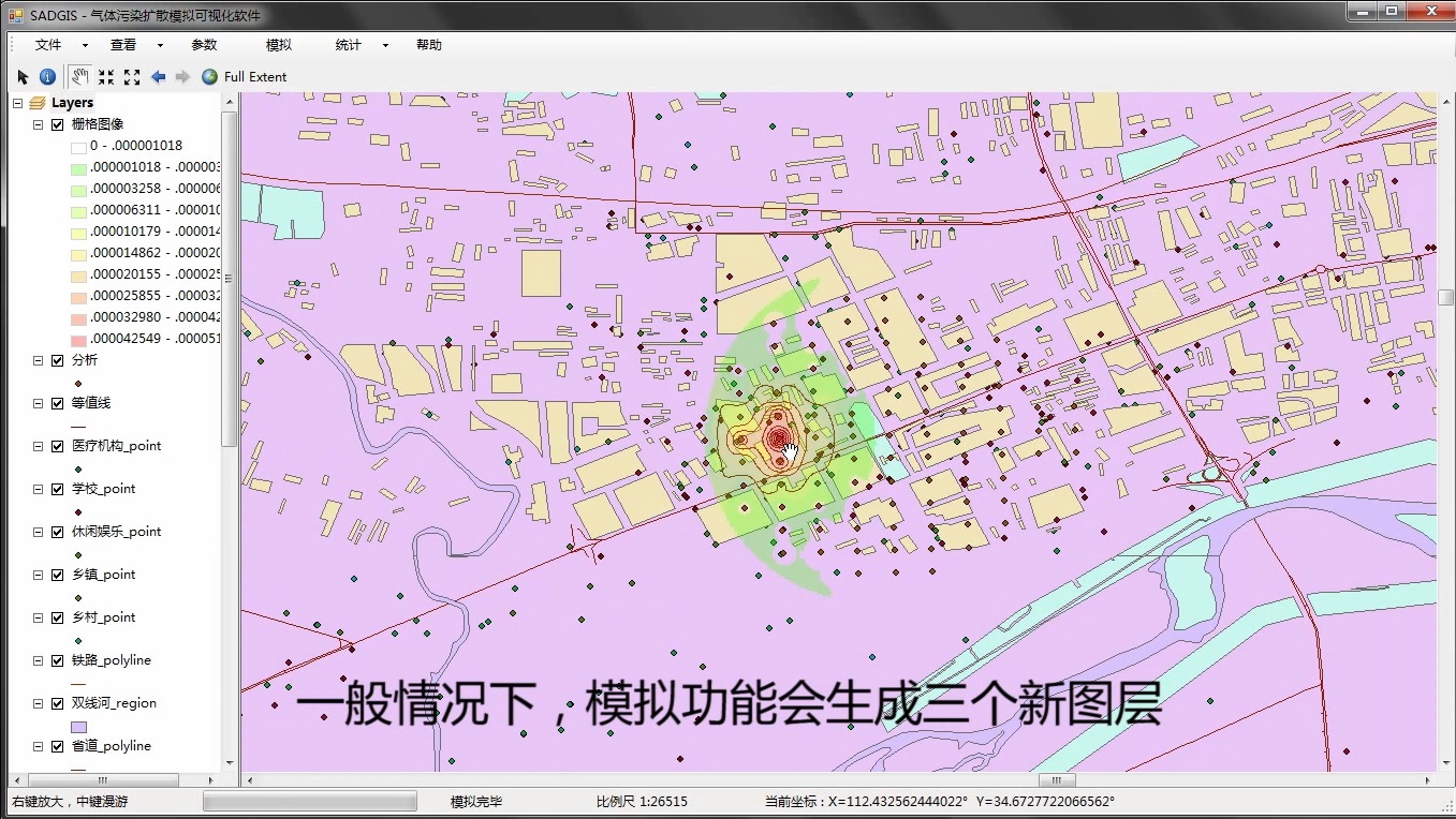
SADGIS is a pollution scattering simulation software based on ArcGIS. Users can input the map data and parameters of wind, then it will calculate the output according to the mathematical model of the atmosphere.
Besides the basic view function, the system can also consider the wind factors and do the statistical computing.
It’s an assignment of Engineering Practice & Contest. And Our team is formed of two c++ programmers.
Comments